
View over Limeni. (1257k)
From the Mani Peninsula entry in Wikipedia:
The Mani Peninsula, also long known by its medieval name Maina or Maïna (Μαΐνη), is a geographical and cultural region in southern Greece that is home to the Maniots, who claim descent from the ancient Spartans. The capital city of Mani is Areopoli. Mani is the central peninsula of the three which extend southwards from the Peloponnese in southern Greece. To the east is the Laconian Gulf, to the west the Messenian Gulf. The Mani peninsula forms a continuation of the Taygetos mountain range, the western spine of the Peloponnese.
The terrain is mountainous and inaccessible.
Until recent years many Mani villages could be reached only by sea. Today a narrow and winding road extends along the west coast from Kalamata to Areopoli, then south to Akrotainaro (the pointed cape, which is the southernmost point of continental Greece) before it turns north toward Gytheio. Another road, that is used by the public buses of the Piraeus - Mani line, which has existed for several decades, comes from Tripoli through Sparta, Gytheio, Areopoli and ends in the Gerolimenas port near Cape Matapan.
A skull of Homo sapiens dating to more than 210,000 years ago was found in the Alepotrypa Cave on the western side of the peninsula. As of 2019 this was the oldest evidence of Homo sapiens in Europe.
Neolithic remains have been found in many caves along the Mani coasts, including the Alepotrypa Cave. Homer refers to a number of towns in the Mani region, and some artifacts from the Mycenaean period (1900 BCE - 1100 BCE) have been found. The area was occupied by the Dorians in about 1200 BCE, and became a dependency of Sparta. After Spartan power was destroyed in the 3rd century BCE, Mani remained self-governing.
As the power of the Byzantine Empire declined, the peninsula drifted out of the Empire's control. The fortress of Maini in the south became the area's center. Over the subsequent centuries, the peninsula was fought over by the Byzantines, the Franks, and the Saracens.
After the Fourth Crusade in 1204, Italian and French knights (known collectively by the Greeks as Franks) occupied the Peloponnese and created the Principality of Achaea. They built the fortresses of Mystras, Passavas, Gustema (Beaufort), and Great Maina. The area fell under Byzantine rule after 1262, forming part of the Despotate of the Morea.
In 1460, after the fall of Constantinople, the Despotate fell to the Ottomans. Mani was not subdued and retained its internal self-government in exchange for an annual tribute, although this was only paid once. Local chieftains or beys governed Mani on behalf of the Ottomans.
The first of these was Limberakis Gerakaris in the 17th century. A former oarsman in the Venetian fleet turned pirate, he was captured by the Ottomans and condemned to death. The Grand Vizier pardoned him, on condition that he took over control of Mani as an Ottoman agent. Gerakaris accepted, using the opportunity to carry out his feud with the strong Maniot family of the Stephanopouloi: he besieged their seat at Oitylo, captured 35 of them, and had them executed. During his twenty-year reign, he shifted allegiance between the Venetians and the Turks.
Following the failure of the Orlov Revolt, in 1776 Mani's autonomous status was recognized by the Porte, and for the next 45 years until the outbreak of the Greek War of Independence in 1821, eight rulers ("beys") reigned over the peninsula on behalf of the Porte.
As Ottoman power declined, the mountains of the Mani became a stronghold of the klephts, bandits who also fought against the Ottomans. There is also evidence of a sizable Maniot emigration to Corsica sometime during the Ottoman years. Petros Mavromichalis, the last bey of Mani, was among the leaders of the Greek War of Independence. He proclaimed the revolution at Areopoli on March 17, 1821. The Maniots contributed greatly to the struggle, but once Greek independence was won, they wanted to retain local autonomy. During the reign of Ioannis Kapodistrias, they violently resisted outside interference, to the extent of Mavromichalis killing Kapodistrias.
In 1878 the national government reduced the local autonomy of the Mani, and the area gradually became a backwater; inhabitants abandoned the land through emigration, with many going to major Greek cities, as well as to western Europe and the United States. It was not until the 1970s, when the construction of new roads supported the growth of the tourist industry, that the Mani began to regain population and become prosperous.
All pictures are © Dr. Günther Eichhorn, unless otherwise noted.


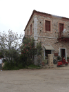


The word Areopoli, which means "city of Ares", the ancient Greek god of war, became the official name in 1912. It was the seat of Oitylo municipality. The Greek War of Independence was started at Areopoli on March 17, 1821 by Petros Pierrakos, also known as Petros Mavromichalis, the last bey of Mani. Now Areopoli has grown into a flourishing town. Its tower houses, constructed with field stones, are distinct from the traditional blue and white buildings that characterize many Greek villages.


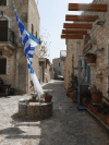
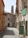
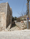


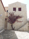
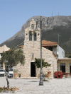

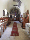
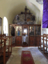

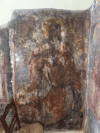

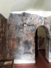

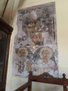


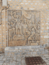
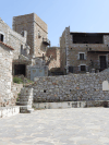
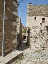
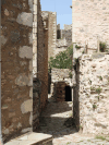
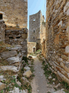
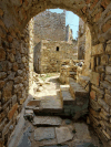
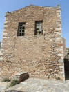
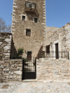
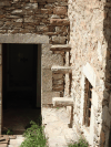
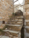
Most houses and walls in this area are build from natural stones, often even irregularly shaped. Many or the old houses have few if any windows to the outside for defensive purposes.

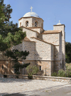

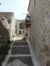
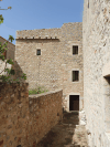
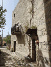
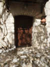

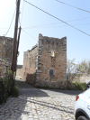
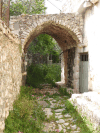
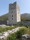
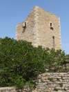
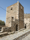
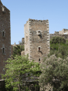
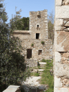
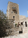
Vatheia (also Vathia) is a village on the Mani Peninsula, in south-eastern Laconia. The local community of Vatheia is named after this village. The aforementioned local community is a subdivision of the municipal unit of Oitylo. It is known for its tower-houses built on a hill dominating the surrounding countryside. Vatheia is linked by road north to Areopoli and Kalamata and south to Cape Matapan also known as Tenaro. In the northern and eastern direction, the southern reaches of the Sangias mountain range overlook the village. Farmland and maquis shrub land cover the hill slopes. On the hills and mountain sides around Vatheia proper are clusters of abandoned houses, towers and chapels known as the perichora, meaning environs. Currently, Vatheia is a tourist attraction during spring and summer due to the abundance of wild flowers that cover the nearby hills and its scenic views. Moreover, it is an iconic example of the south Maniot vernacular architecture as it developed during the 18th and 19th centuries.
Vathia is first mentioned in 1571, by a Venetian diplomatic mission, as "casale di Vathia". In 1618, an unofficial census was conducted by an agent of Charles, Duke of Nevers named Philipe de Lange Châteaurenault in cooperation with a prominent Maniot clan leader named Pietro Medici. The village was recorded as "vatia" with 20 hearths. In 1700, the Grimani census was carried out for the newly established Kingdom of the Morea. The Venetians recorded a total population of 212 persons distributed in 54 families. The reasons for this substantial population growth over the 17th century are unclear.
On 13 April 1805, William Martin Leake by-passed Vatheia ("Βάθια" in text) on the way to Cape Matapan, using the sea-side road, but his journey was briefly interrupted by a band of local armed men. His guides, being Maniots themselves, negotiated passage and informed him that Vatheia has been divided in two warring parties for the past 40 years. They estimated that about 100 men had been killed since the beginning of this clan war. Leake also informs us that Vatheia and its environs consist of three adjacent villages. Between 1750 and 1900 the main nuclei of habitation, apart from the village itself, were several hamlets spread over the whole region controlled by the Vathia clans and their allies. Of the eight clans, in total, the four larger were living in Vatheia proper and its environs (Karabatiani, Michalakiani, Kaledoniani, Koutrigari) while the rest were mostly restricted in some of the aforementioned hamlets.
On 15 August 1806, representatives of many prominent Maniot clans gathered in Marathonisi to sign an oath of fealty to Andonis Grigorakis, Bey of Mani. The entry for Vatheia was as follows: "Michalakiani, Gerandoniani and Karabatiani and the environs, we abide collectively". The communal decision to swear fealty to the Bey might have signaled the end of the war mentioned by Leake a year earlier. Furthermore, this is the only known mention of the Gerandoniani clan. The local clan war that started in 1764 was the catalyst in the formation of the clans which dominated the region from the 19th century until its, nearly total, abandonment during the post-WWII years.
In several places around the modern village as well as in other locations within the periphery of the local community, earlier habitation is evident by the megalithic remains of housing clusters. The closest to modern Vatheia are the Palaiochora built along a stream below the modern village, the Kostakianika Kalyvia built on the hillside a short distance to the north-west and Pachia a similar hamlet on the mountainside just opposite the hill of modern Vatheia. They belong to the category of megalithic structures named after the large, roughly-hewn blocks of stone used by the builders. This is a term used throughout Mani to describe the older abandoned settlements sharing the aforementioned characteristic construction.







This page contains 68 pictures
Here are the links to the other main pages on Greece:
Page last updated on Fri Jul 8 18:49:59 2022 (Mountain Standard Time)
Page last updated on Wed Apr 24 18:35:26 2024 (Mountain Standard Time)
Mani Peninsula on soaring.guenther-eichhorn.com